Lavanya Gopal GIS | Data Science | Remote Sensing | Engineering

  • Home
  • Resume

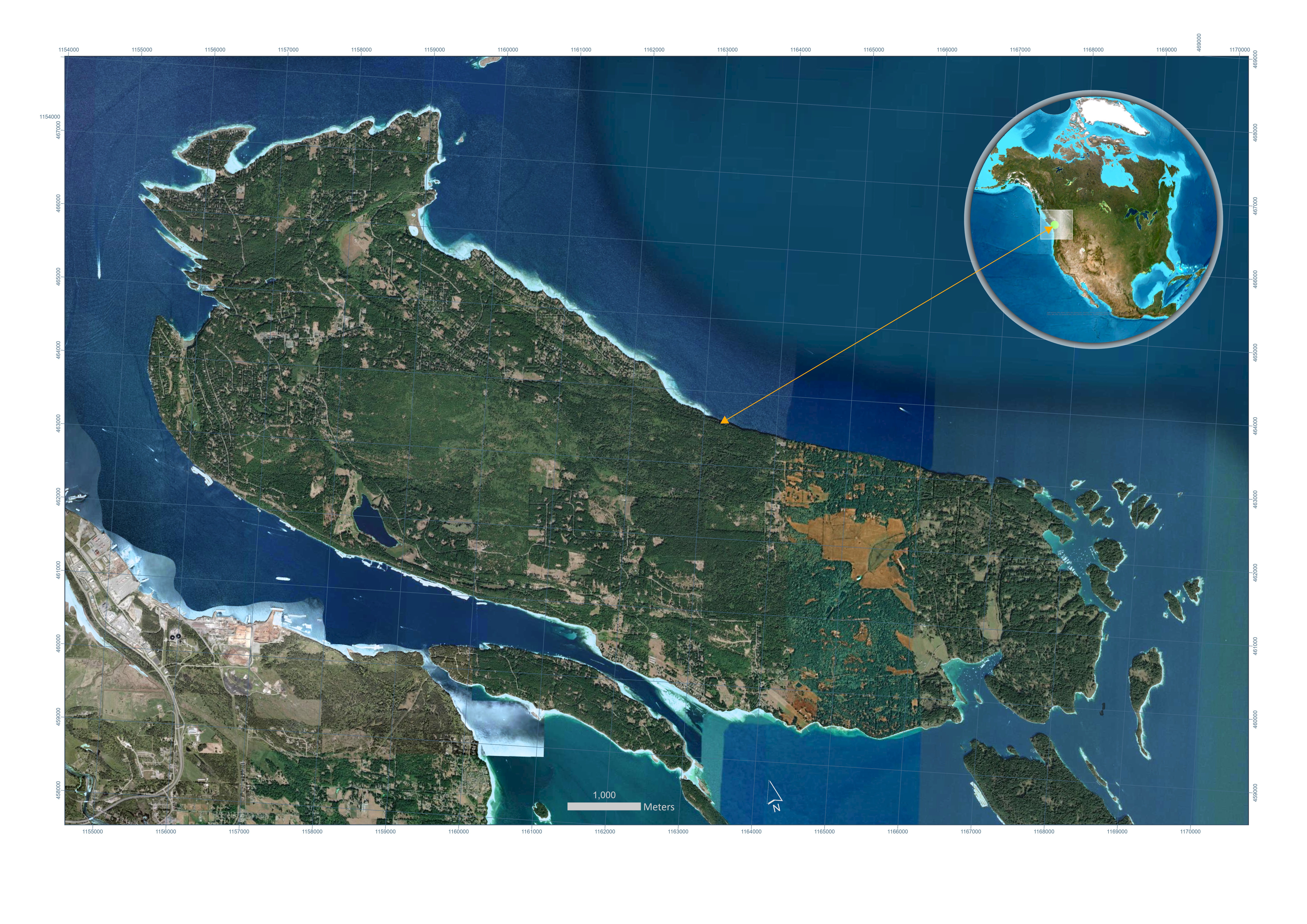
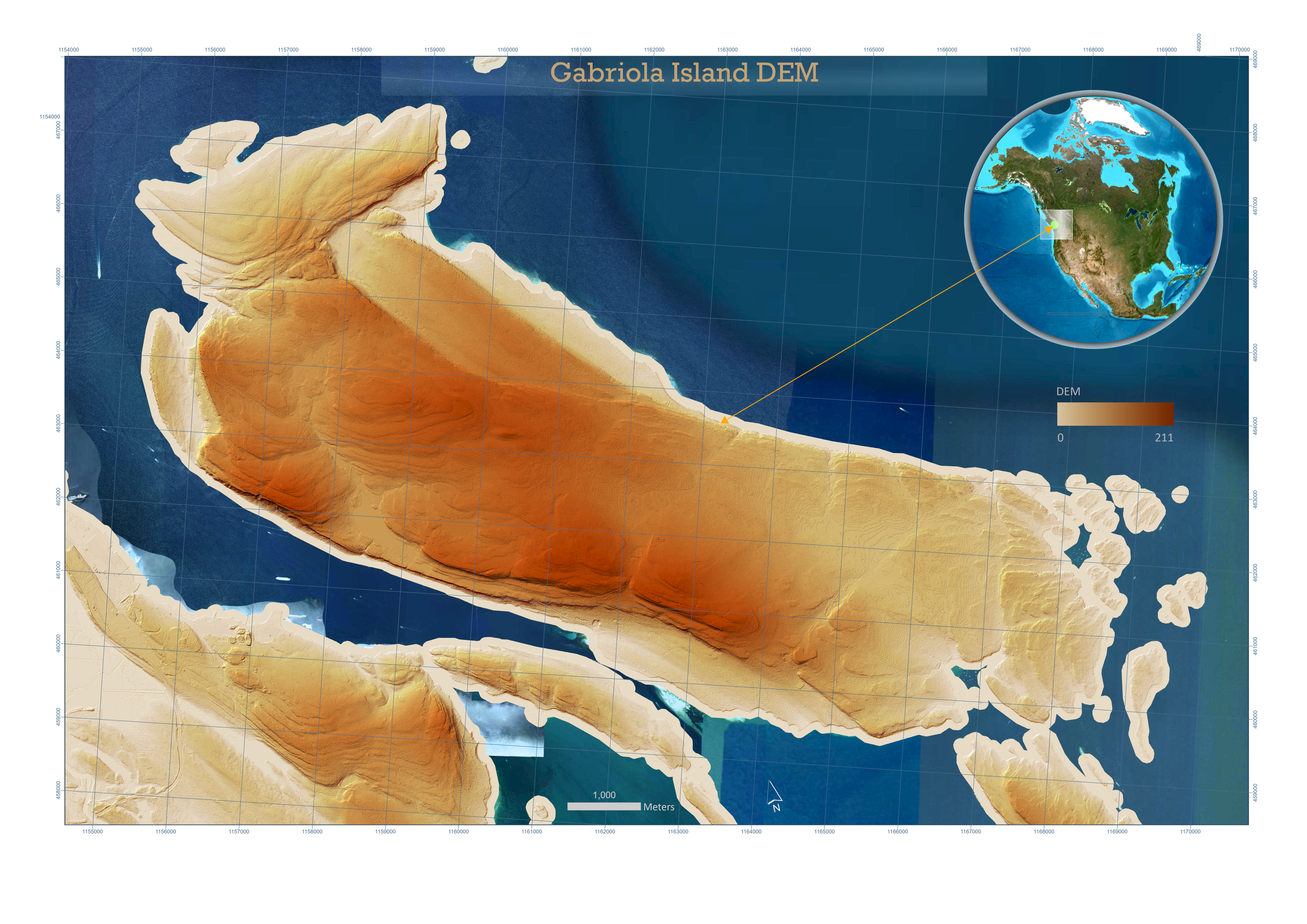
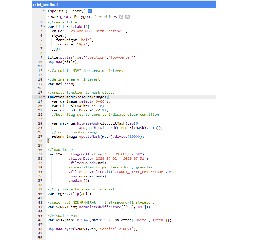
NDVI Using Google Earth Engine


  • Gabriola Island, located in the Strait of Georgia in British Columbia, Canada, covers approximately 57.6 square kilometers and has a resident population of around 4,500. Remote sensing techniques are used to visualize the island's geography, terrain, and vegetation health. Google Earth Engine, a powerful cloud-based geospatial analysis platform, facilitates the visualization and analysis of satellite imagery.
  • First, we explore the base map imagery of Gabriola Island, revealing a brown-colored area in the eastern part of the island that indicates a lack of forest or vegetation. To investigate this area further, we turn to satellite imagery.
  • Second, we see a composite Sentinel imagery from July 2020 with the calculated Normalized Difference Vegetation Index (NDVI). In this map, blue indicates healthy vegetation, while lighter green represents areas with little to no vegetation or bodies of water.
  • The third image presents a digital elevation model (DEM) with an overlaid hillshade to enhance the visualization of the island's terrain. Finally, the source code for the analysis conducted on Google Earth Engine is provided, allowing for reproducibility and further exploration of the data.