ArcGIS Quick Capture is a mobile application designed for rapid data collection in the field. It allows users to capture geographic information quickly and efficiently, making it ideal for scenarios where speed is essential, such as emergency response or environmental monitoring. The app supports various data types, including points, lines, and polygons, and can be customized to suit specific data collection needs.
Take a look at these examples:
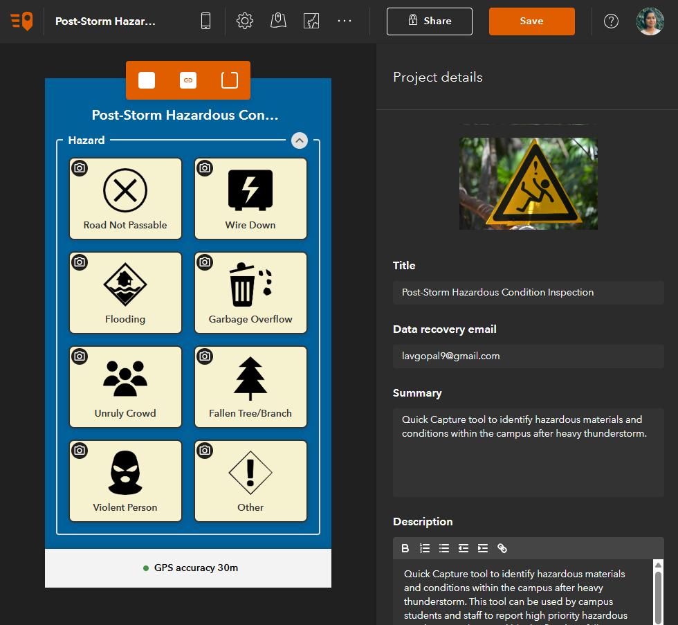
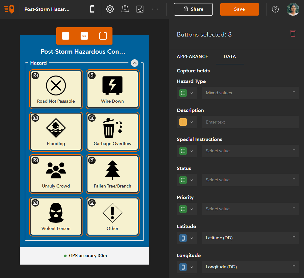
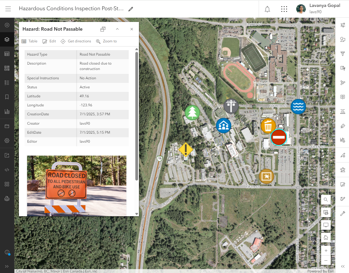
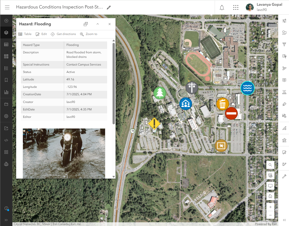
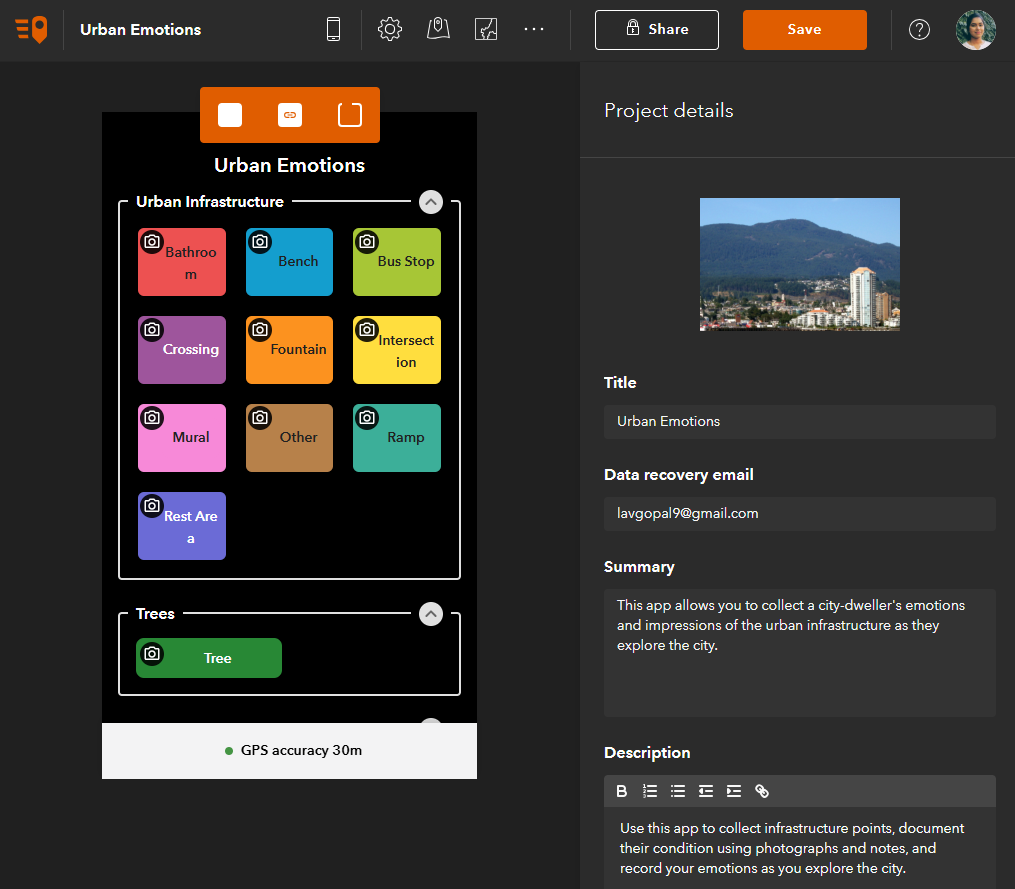
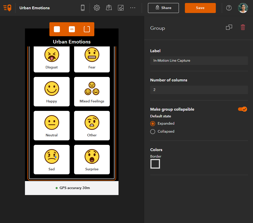
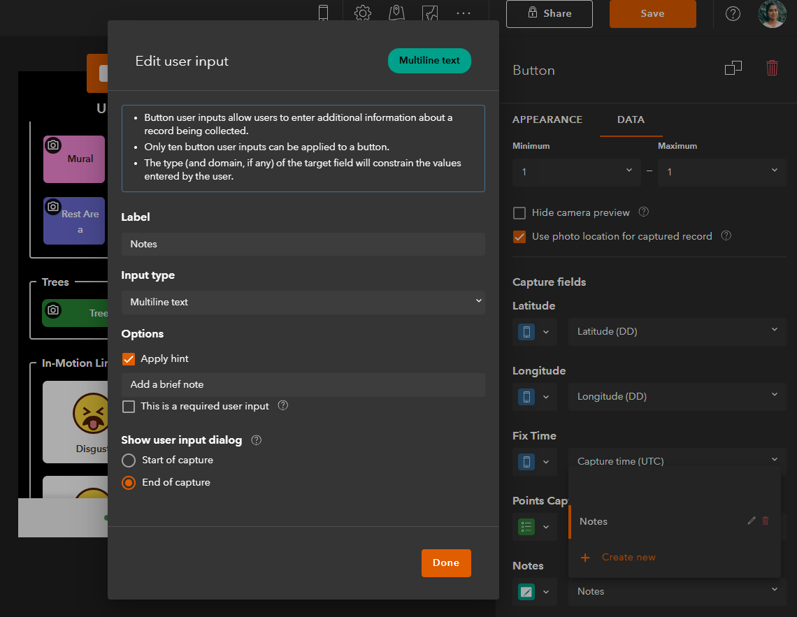
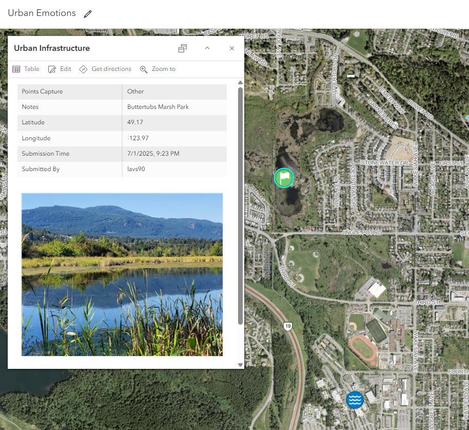
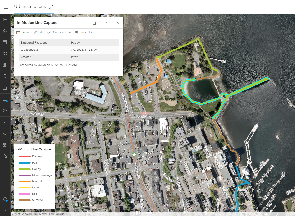
Post-Storm Conditions and Urban Emotions: Two field data capture tools developed using Quick Capture for identifying post-storm conditions around a campus and capturing interesting urban infrastructure and features. Technician can create and edit points, lines, and polygons, on-the-go while collecting associated photos and attributes. Key features include collecting single or streaming points, attaching photos and videos, as well as populating attributes using coded-values, multiline user text input, and arcade expressions.