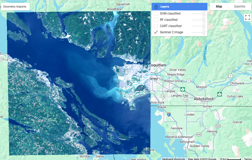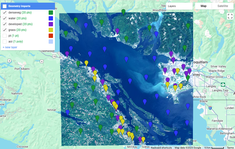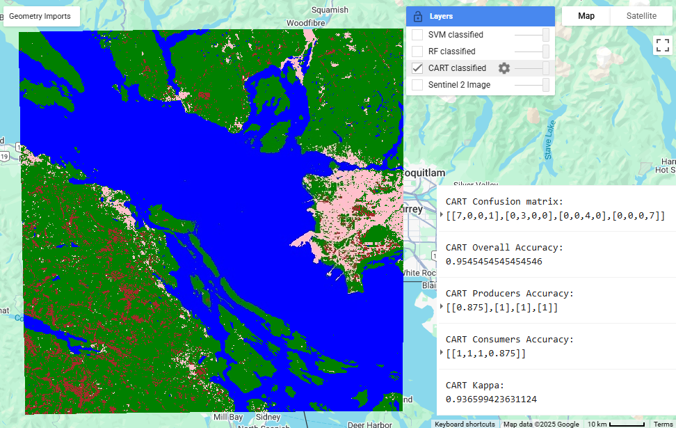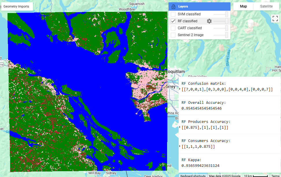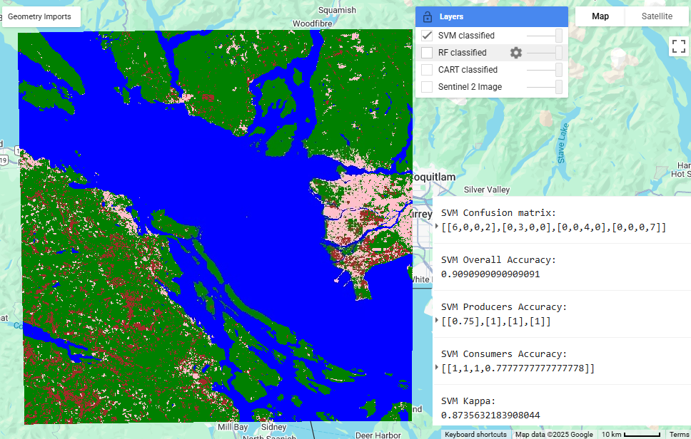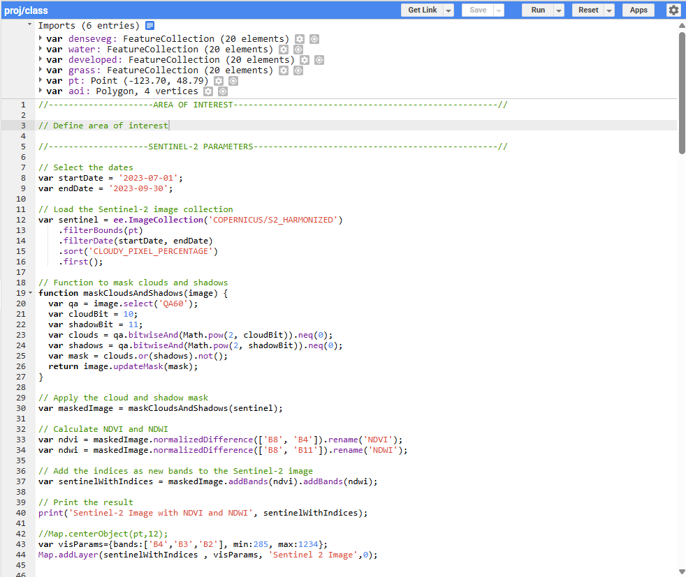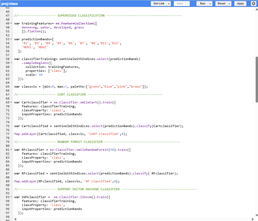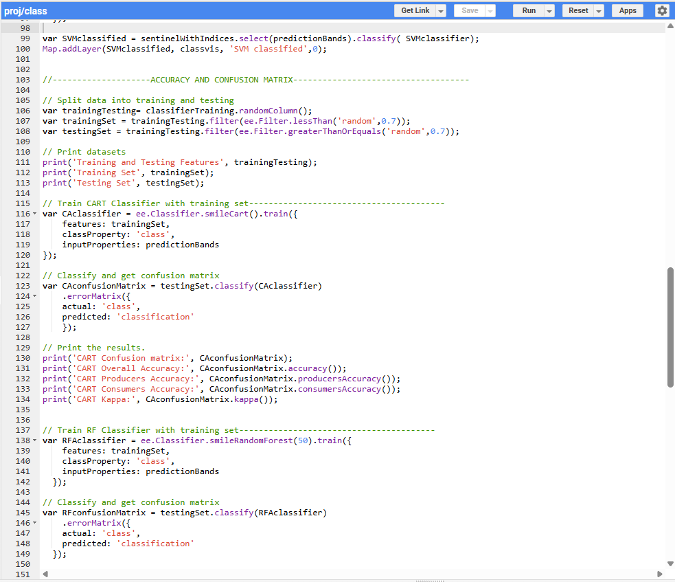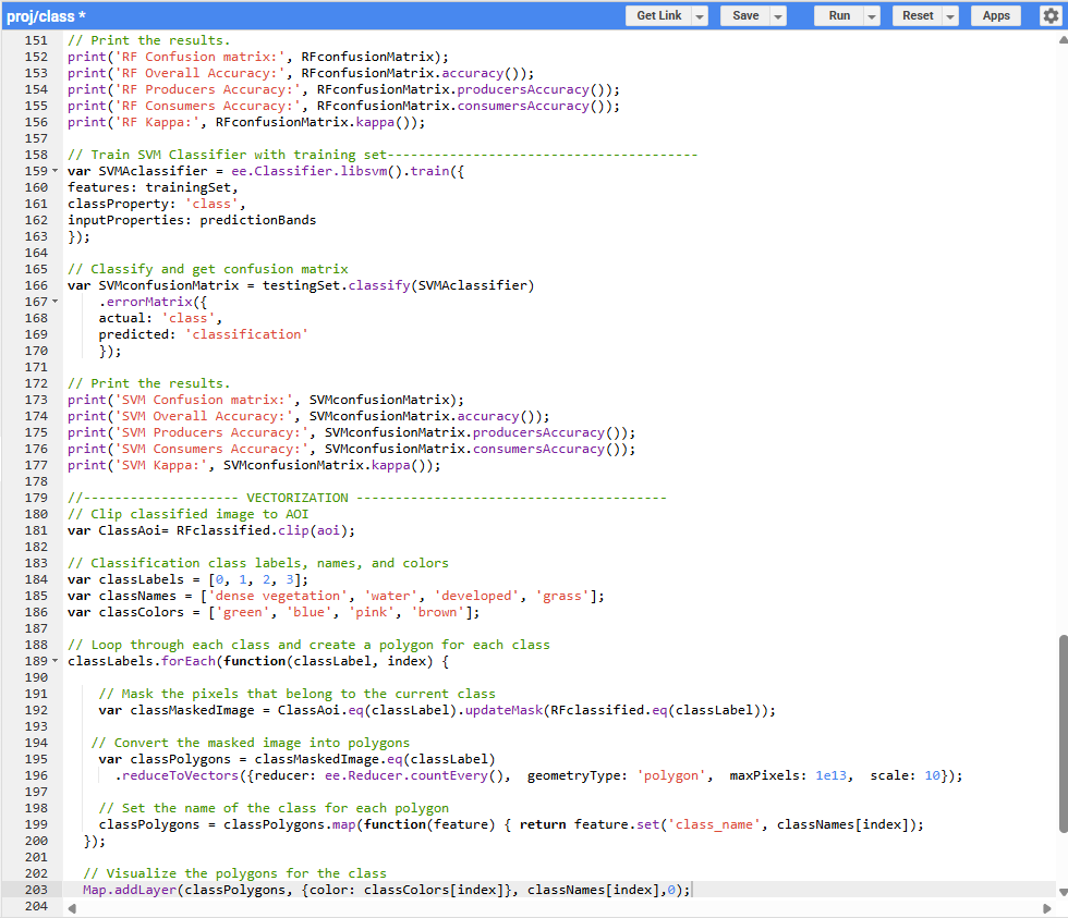
Land cover classification using Sentinel-2 satellite imagery leverages multi-spectral data to identify and categorize surface features. This project used supervised classification techniques, which involved generating training samples, teaching the model to recognize spectral signatures, and classifying the imagery into distinct land cover types. I applied three machine learning algorithms— Classification and Regression Tree (CART), Random Forest (RF), and Support Vector Machine (SVM)—to distinguish between classes such as water, forest, grassland, and urban areas. Classification accuracy was assessed using a confusion matrix, overall accuracy, and the Kappa coefficient. The results demonstrate the robustness of machine learning approaches in extracting meaningful insights from satellite imagery. Scroll down to explore results from the classification process.