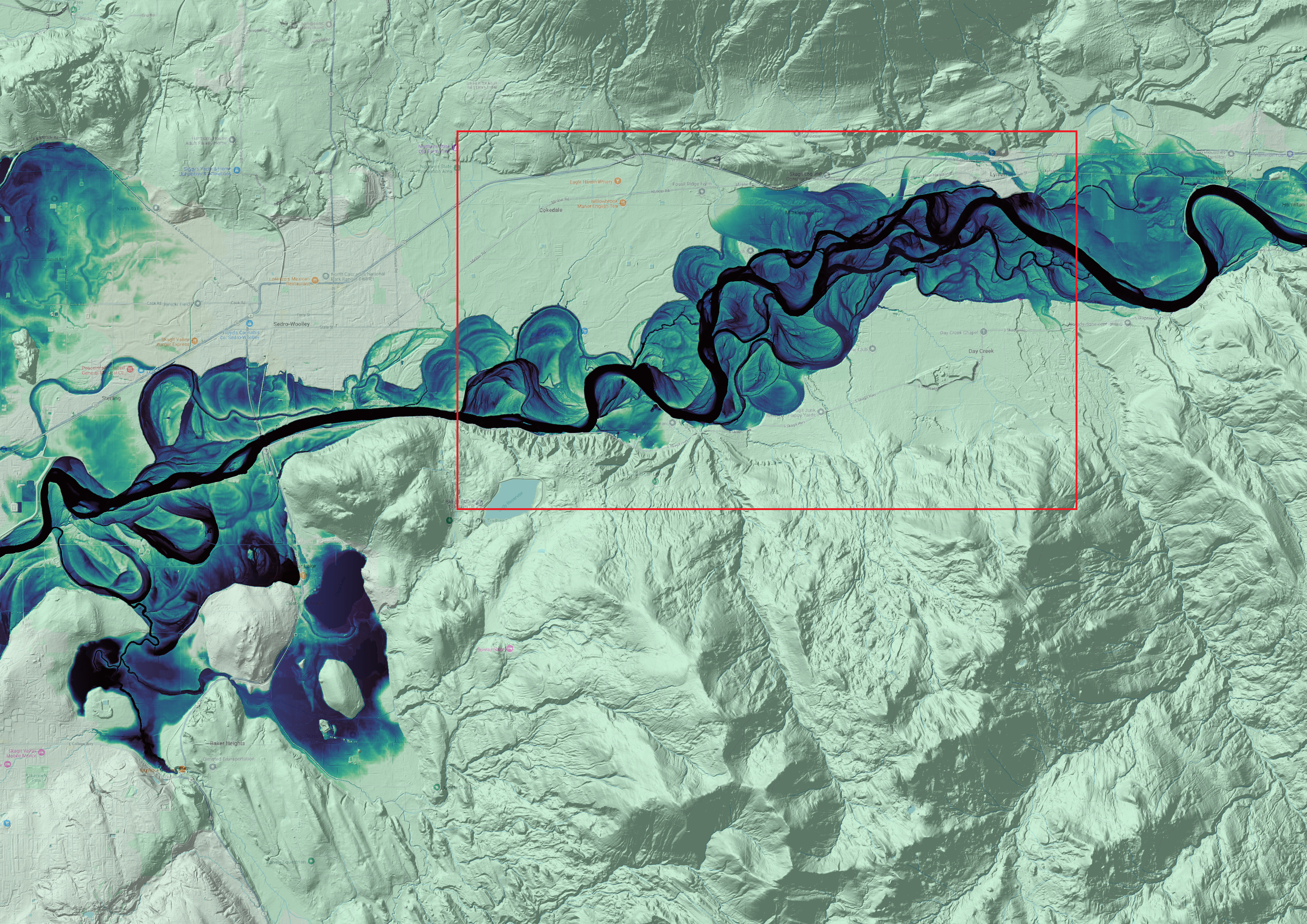
A Relative Elevation Model (REM) is a raster dataset that shows elevation values relative to a river’s water surface, rather than to sea level. While similar to Digital Elevation Models (DEMs), which represent elevation relative to sea level, REMs specifically display elevation relative to the river's water surface. REMs are used to visualize river corridors and floodplains, analyze river landform sequences, and predict substrate size classes by highlighting local topographic variations. This makes it easier to identify patterns in lower elevations and better understand river dynamics.
This map is based on the tutorial by Dan Coe Carto: Creating REMs in QGIS with the IDW method. The river used in this tutorial is the Skagit River, located in Washington State, USA (48°30'09.2"N, 122°06'48.5"W).