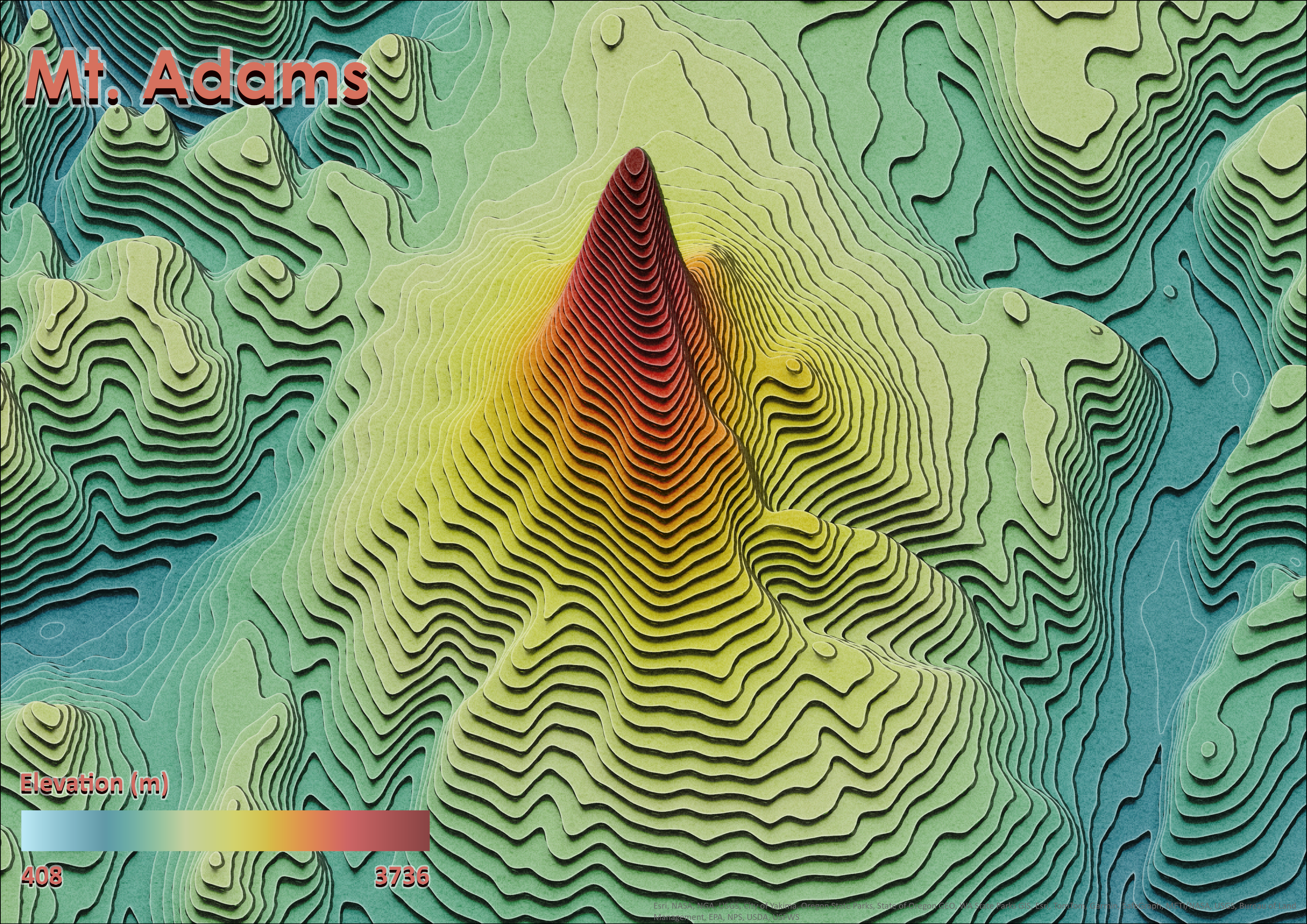
In cartography, a contour line connects points of equal elevation (height) relative to a specified reference point, such as mean sea level. Contour maps use these lines to illustrate terrain features like valleys, hills, and the degree of slope steepness or gradual inclines. For example, on this map of Mt. Adams in Washington State (USA), contour lines are spaced at 50-meter intervals, effectively capturing changes in elevation. The trippy contours in this map combines traditional 'shell-up' contours with creative shadow effects, layer blend, and lighting elements creating a mesmerizing, psychedelic visualization of terrain.
This map follows a tutorial by John Nelson: Re-creating Trippy AI-Generated Terrain Contours. The DEM for this map was downloaded from NASA Earthdata 30m SRTM.