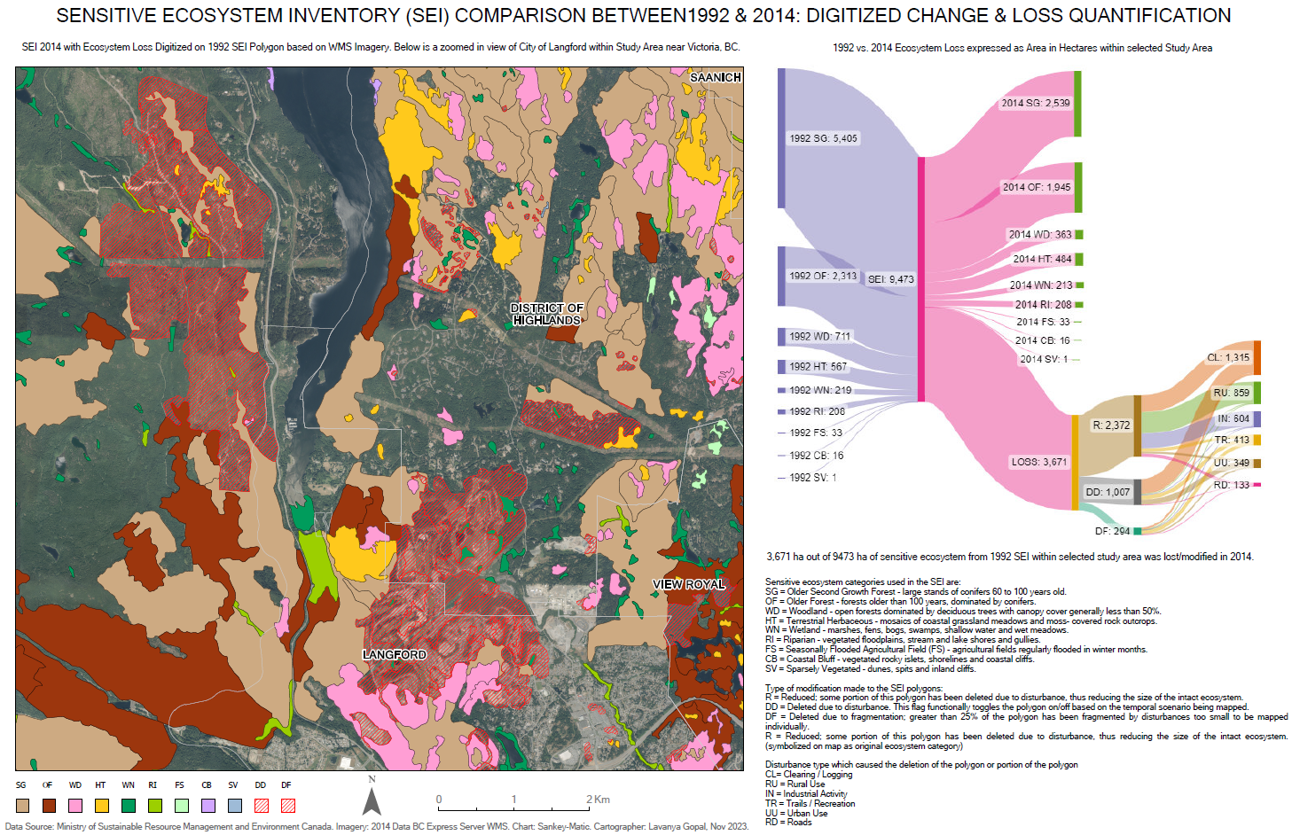
An ecosystem refers to a section of the landscape characterized by relatively uniform dominant vegetation. A sensitive ecosystem, in contrast, is one considered rare, fragile, or especially vulnerable to disturbance. The east coast of Vancouver Island is among only four critical areas in Canada where remnants of natural ecosystems persist, now surviving as fragmented patches amid growing development. The Sensitive Ecosystem Inventory (SEI) aims to support land-use planning and guide conservation efforts by identifying and mapping these vital landscapes. To visualize the scale and nature of ecosystem change, Sankey diagrams can be used. These flow diagrams illustrate transitions such as from one land cover type to another over time. The width of each flow is proportional to the magnitude of change, clearly conveying which ecosystems were retained, degraded, or converted.
The interactive Sankey dashboard created in Google Looker Studio highlights how ecosystems across the study area evolved between 1992 and 2014. Explore the dashboard and map below to see where and how sensitive ecosystems were impacted over time.